(RADAR)
(RF-HEAD)
(ANTENNAS)
(PROCESSING)
(WEATHER)
(HOME)
Homemade FM weather radar at 10GHz
Matjaz Vidmar, S53MV
5. Weather observations
Radars cover a very broad range of much different devices, spanning from inexpensive door-opener devices up Earth-based radars capable of inspecting the surface of other planets. Weather radars fall somewhere in between these two extremes. Practically useful weather information can be obtained with amateurs-size antennas of less than 1m diameter.
Looking back in history a question arises as which type of radar is better: pulsed, FMCW or even some other type of modulation (noise) performs better? A pulsed radar requires little signal processing at the expense of a high transmitter peak power. A FMCW radar requires about 1000-times less peak power but separate transmit and receive antennas to keep the unwanted crosstalk low enough. The transmit-receive crosstalk is even more difficult to control in a noise radar.
Pulsed radars are rather sensitive to interference and/or jamming. Due to its high pulsed power, a pulsed radar is also rather easy to detect by an enemy. Due to using a homodyne receiver, FMCW radars are much less sensitive to any interference. Due to lower power, FMCW signals are much more difficult to detect by an enemy. FMCW radars are widely used as aircraft altimeters. The same aircraft carries two or three altimeters operating in the same 4.2-4.4GHz frequency band. Using different FM sweep rates is enough to avoid any mutual interference.
The proposed FMCW weather radar uses a transmitter power of just 30mW at 10GHz. The latter allows observing a minimum precipitation reflection of about +20dBZ (light rain).
In most radars the sensitivity is compensated for the increasing distance. In an aircrat radar, the target is much smaller than the antenna beam and the reflected power decays with the fourth power of the distance. In a weather radar, the target is usually larger than the antenna beam and the reflected power decays with the square of the distance. Therefore a single RC highpass "preemphasis" in the RF head is enough for distance compensation. Very low beat frequencies below 100Hz are additionally attenuated in the RF head to remove antenna crosstalk.
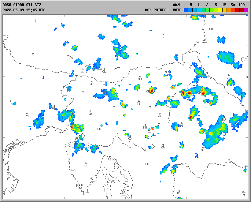
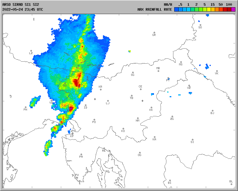
In my area most precipitations come from west. The ARSO radar shows little precipitation around Nova Gorica:
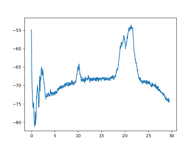
The same precipitation can be observed in real time on the beat spectrum of the described FMCW radar:
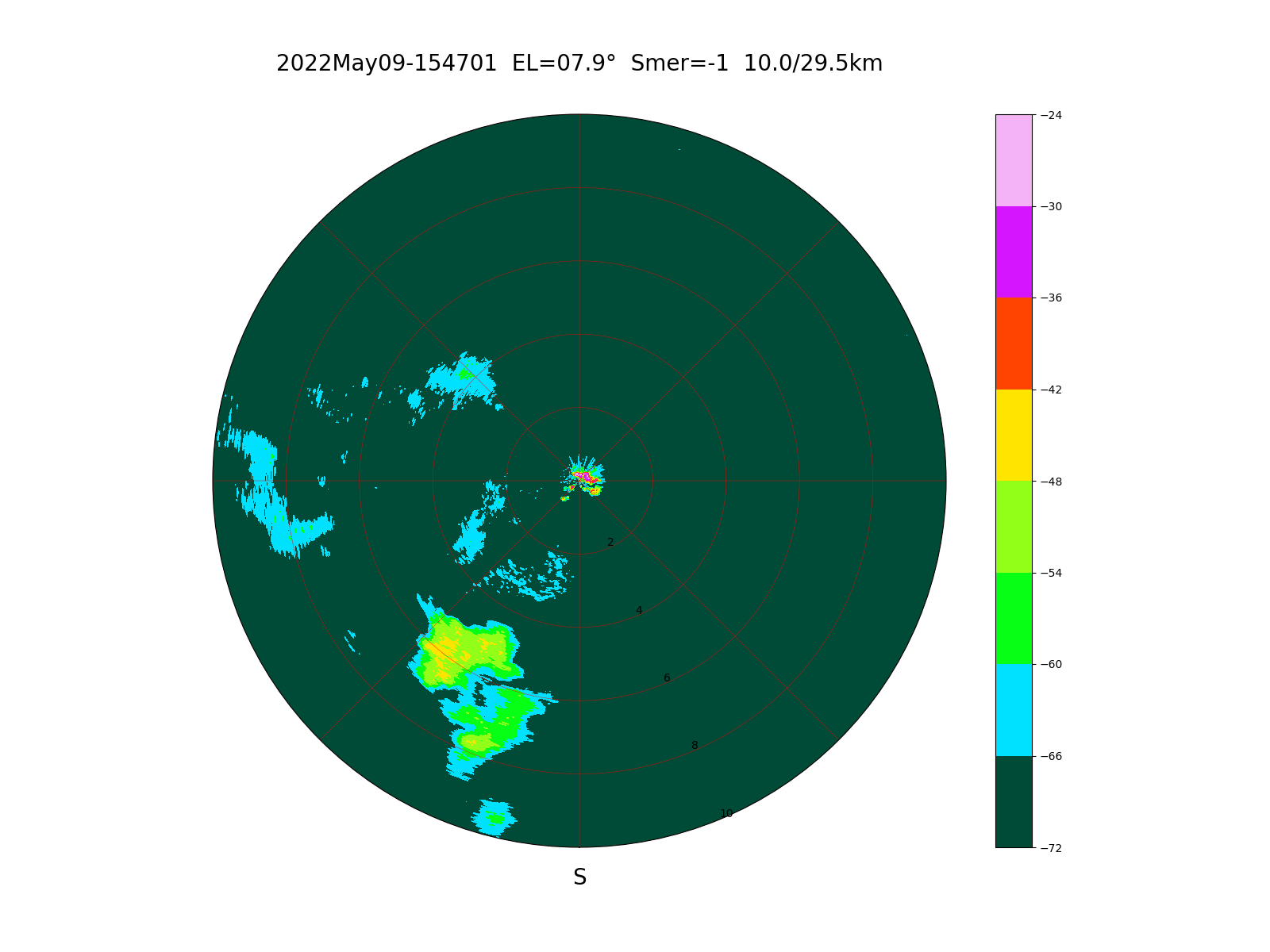
The corresponding PPI image was taken a few minutes later at an antenna elevation of 8 degrees. Besides reflections from clouds within 10km range, reflections from nearby houses are also visible:
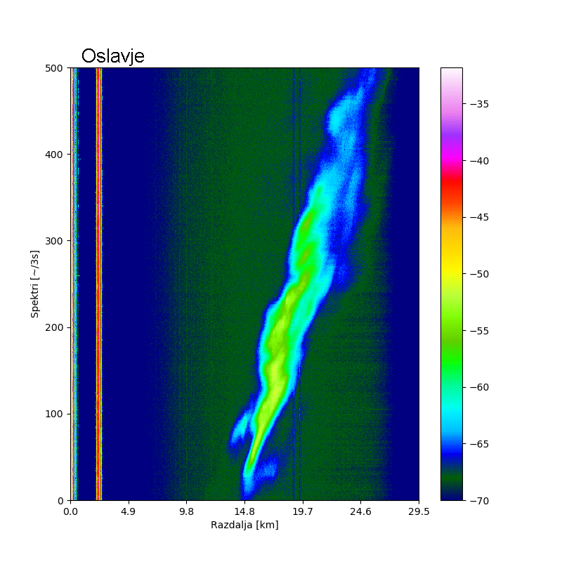
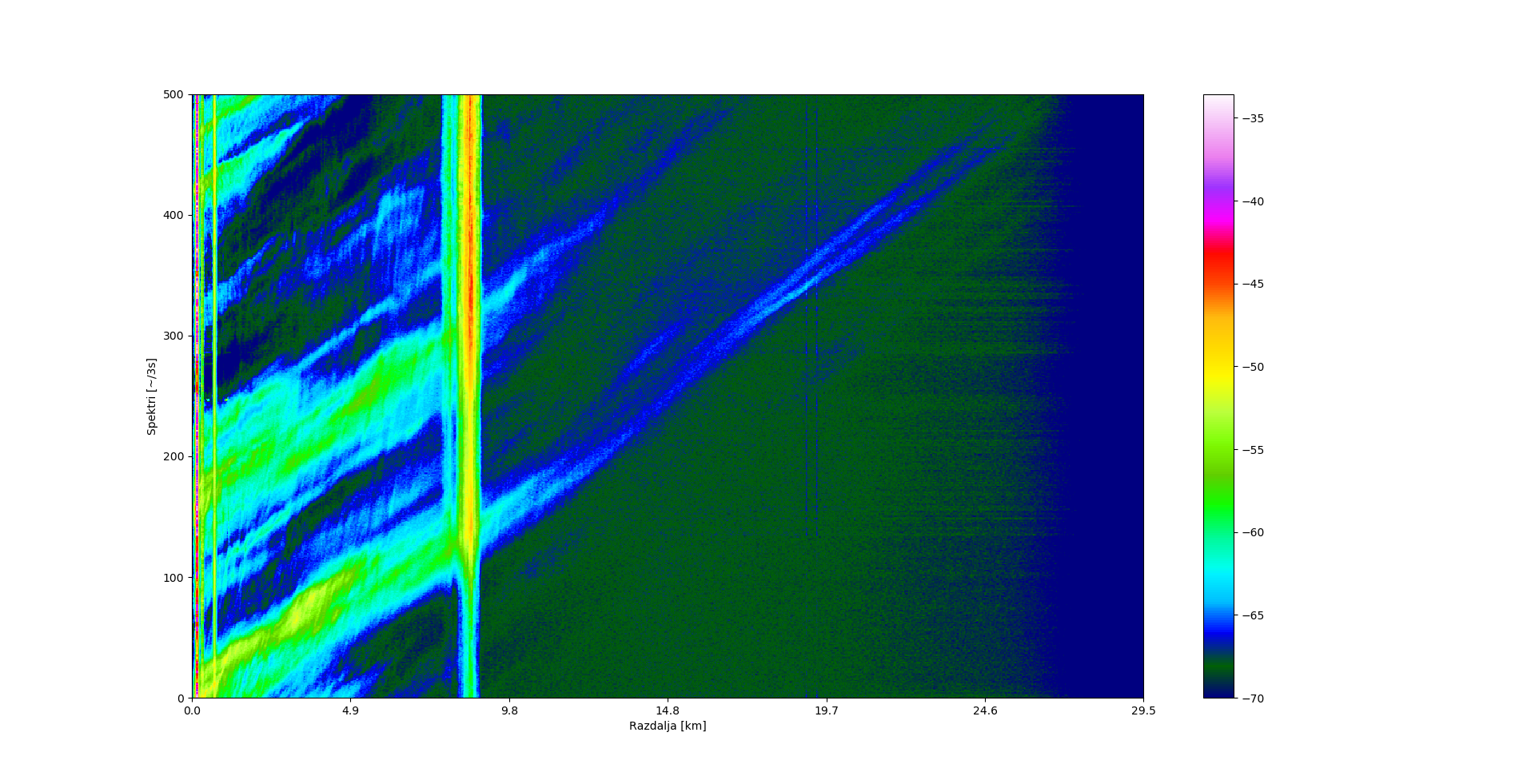
The development of short localized thunderstorms is best observed as a waterfall spectrogram at low elevation in the direction NW on June 3rd, 2025:
or as a waterfall spectrogram at even lower elevation in the direction S on June 5th, 2025:
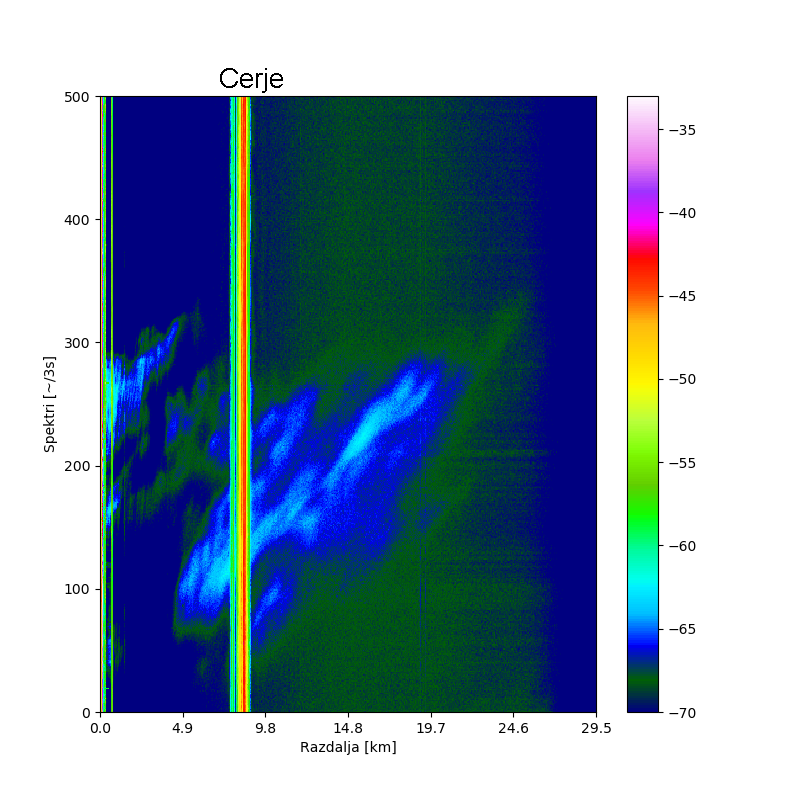
If a reliable radar return from a fixed target is known, rainfall signal attenuation between the radar and the reference target (Cerje) can be observed directly like on Sep 10th, 2025:
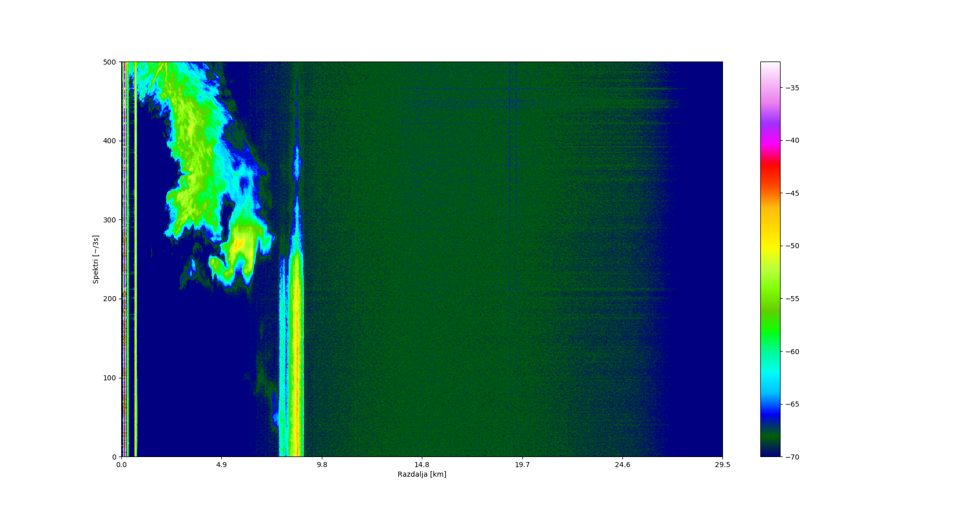
As soon as the rain ends, the reflection from the reference fixed target (Cerje) is restored as on Sep 16th, 2025:
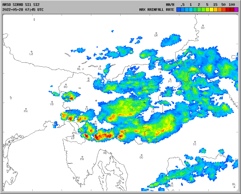
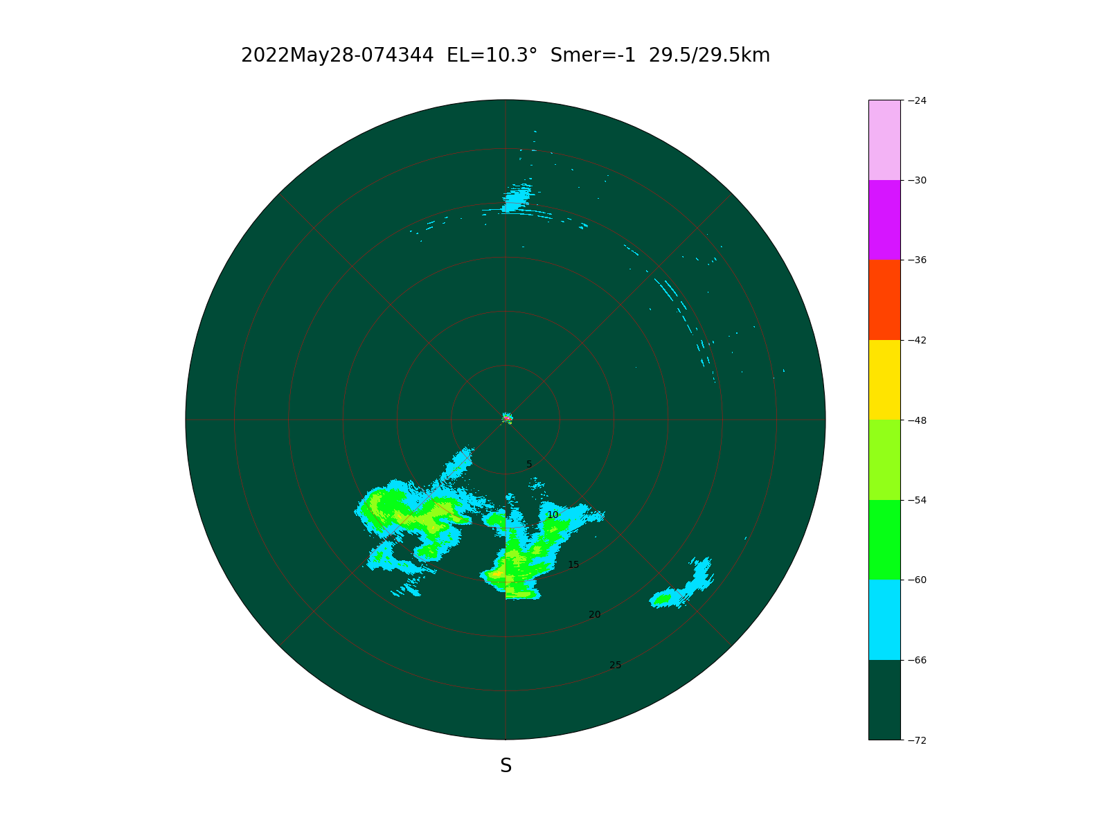
Data from a small weather radar can not always be trusted. The ARSO radar image of a heavy rainfall in Nova Gorica shown below:
The scanning of the small weather radar was form weast to east. There is almost no rainfall in the last quadrant from east to south within 1km range. What really happened? In spite of the high elevation almost 17 degrees rain water temporarily flooded both feedhorns while the antenna facing east:
Without radome the rainfall is much weaker in the last quadrant from east to south within 10km range. The feedhorns only dried up back to normal sensitivity the next day:
At 10 degrees elevation rainfall in most directions can be observed up to a distance of 25km due to Earth's curvature:
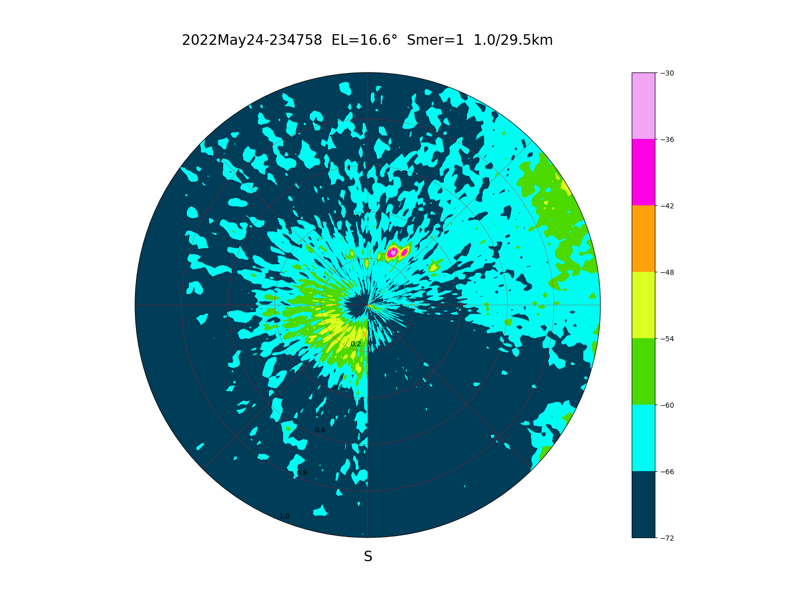
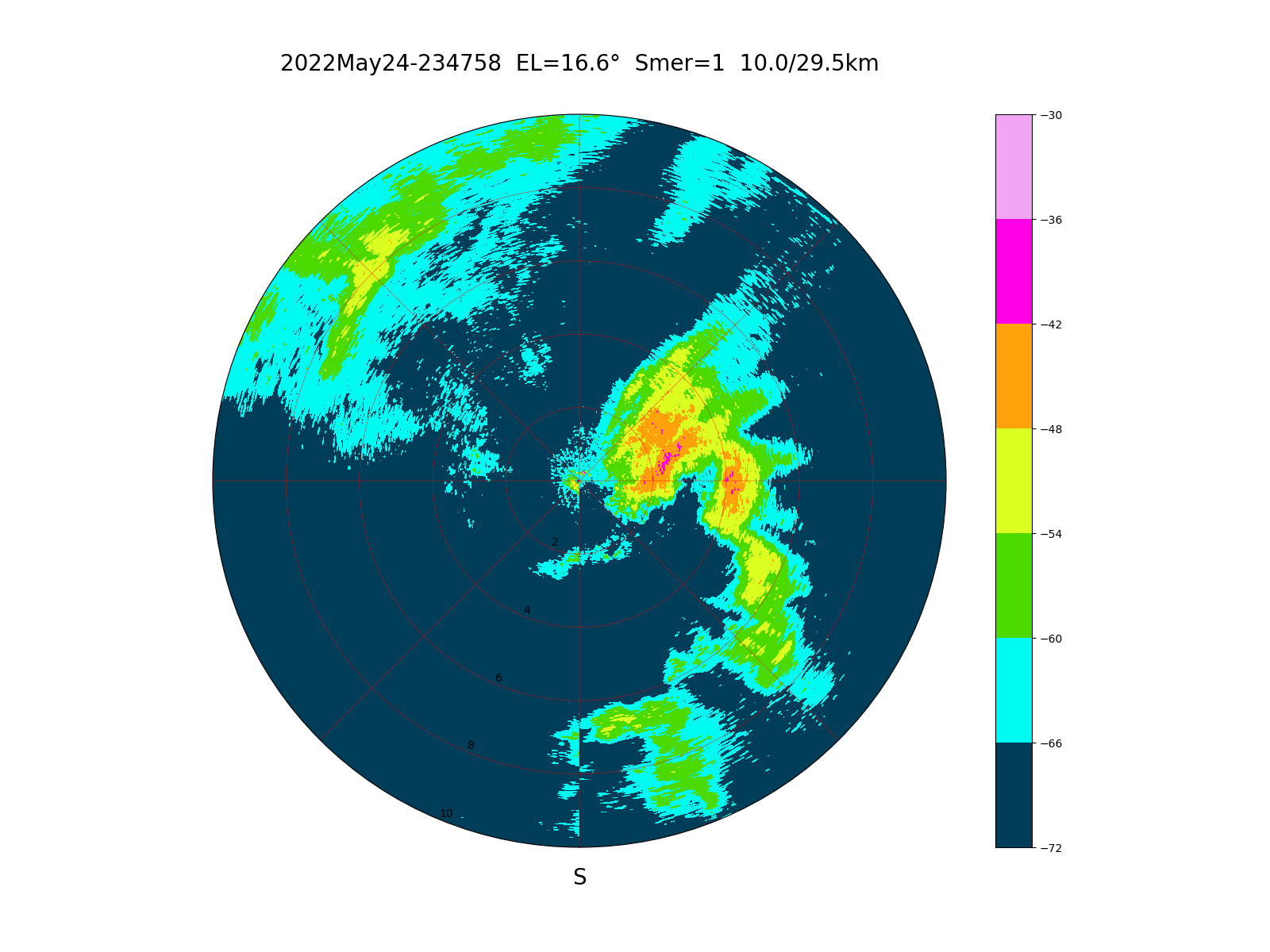
On june 23rd, 2022 precipitations were centered on my location:
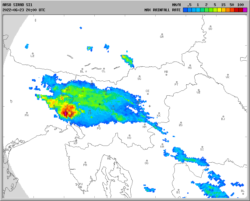
Most precipitations are visible within 1km:
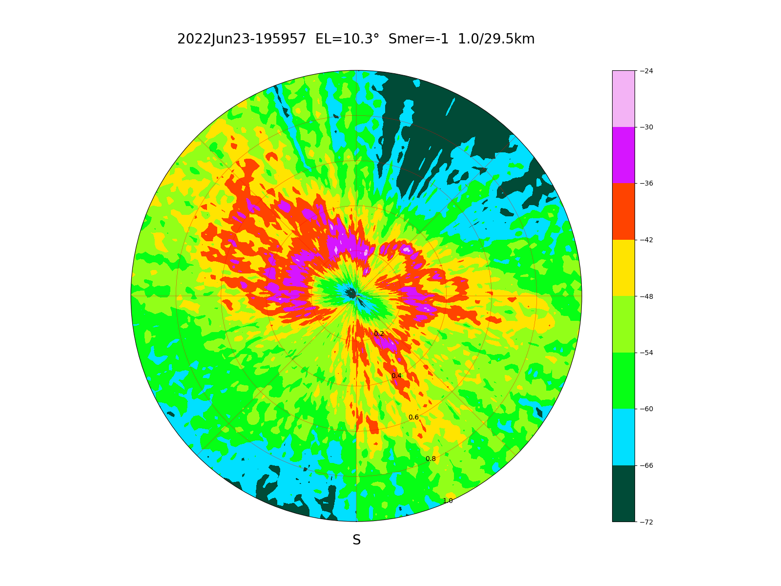
Precipitations already look weaker within 4km:
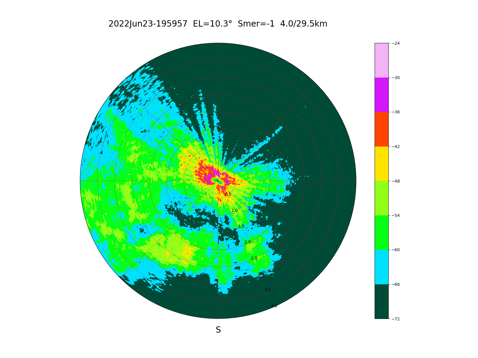
Within 10km the attenuation at 10GHz is already noticeable:
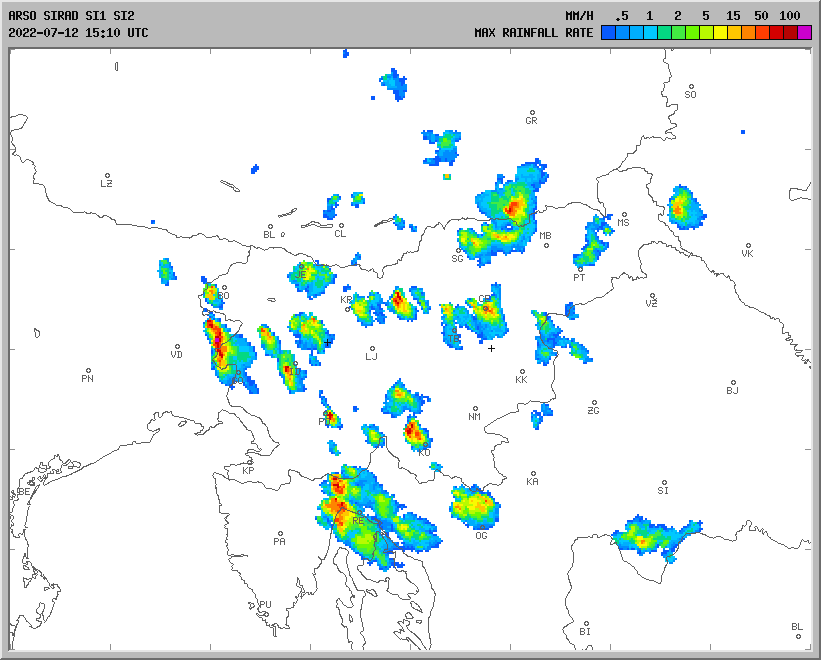
Precipitations and ground obstacles are visible on July 12th, 2022:
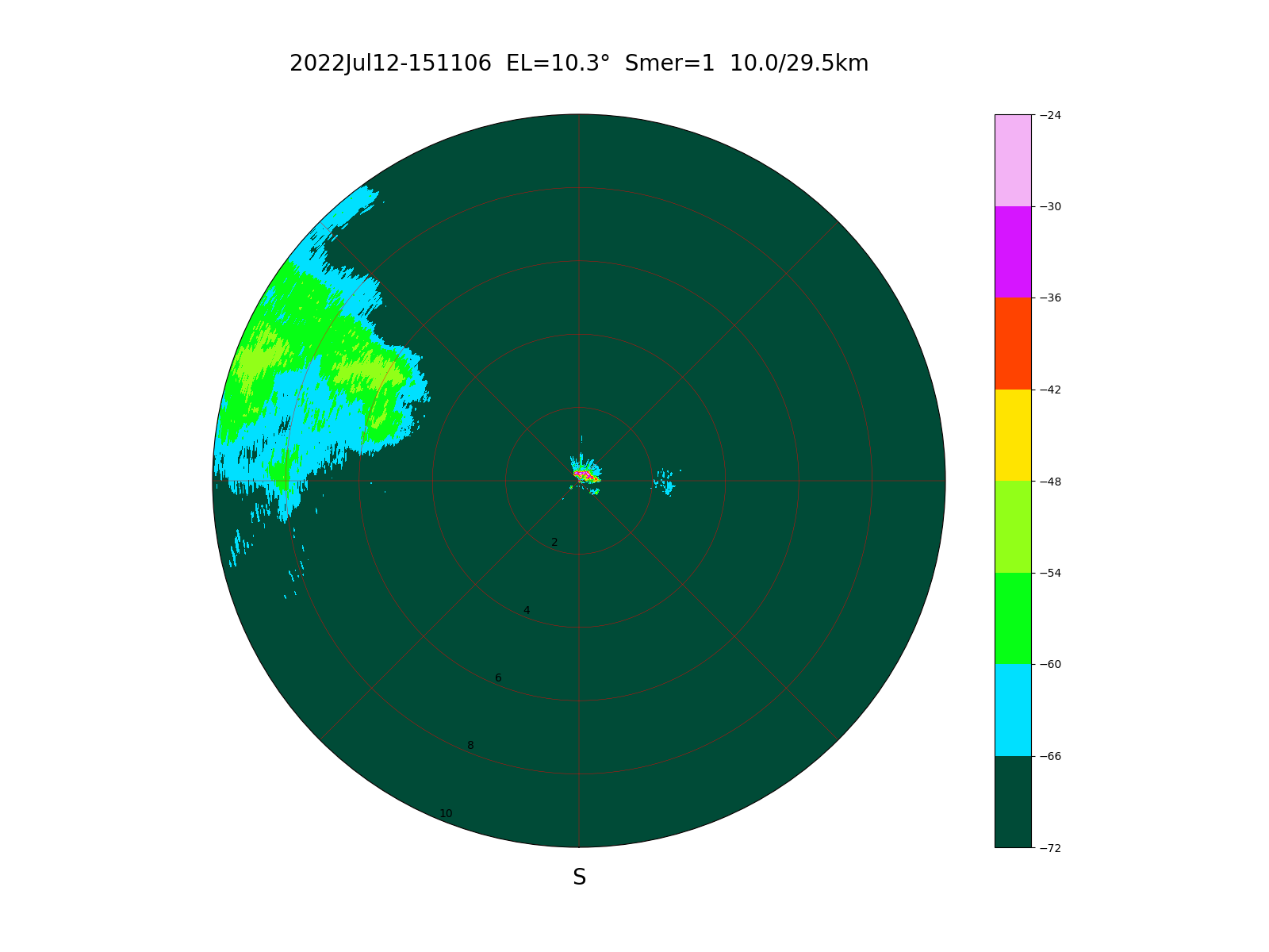
Precipitations and ground obstacles within 10km:
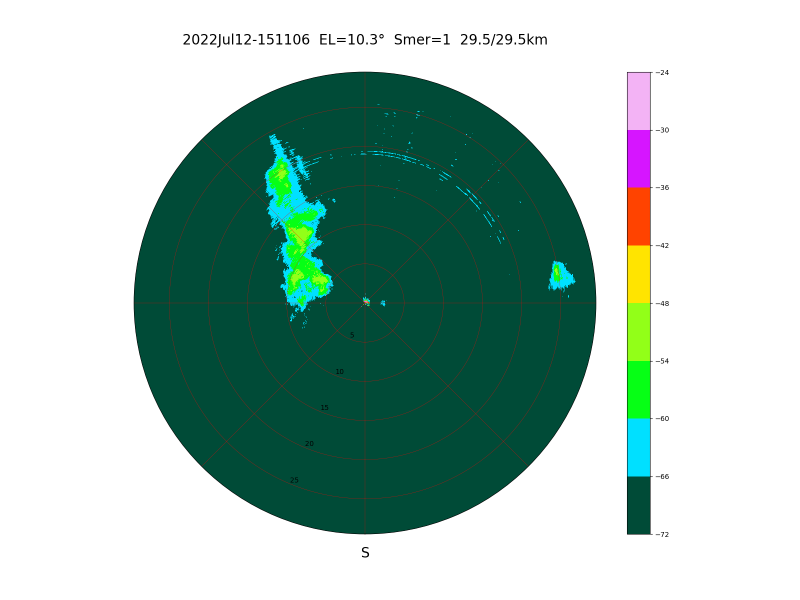
Including some interference within 29km:
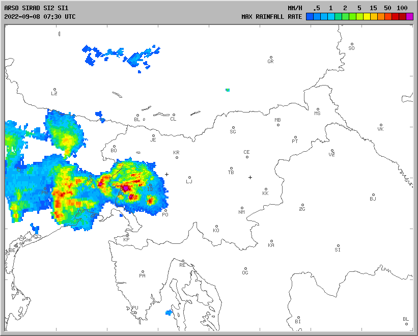
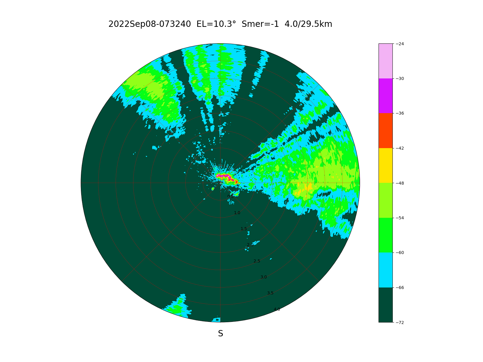
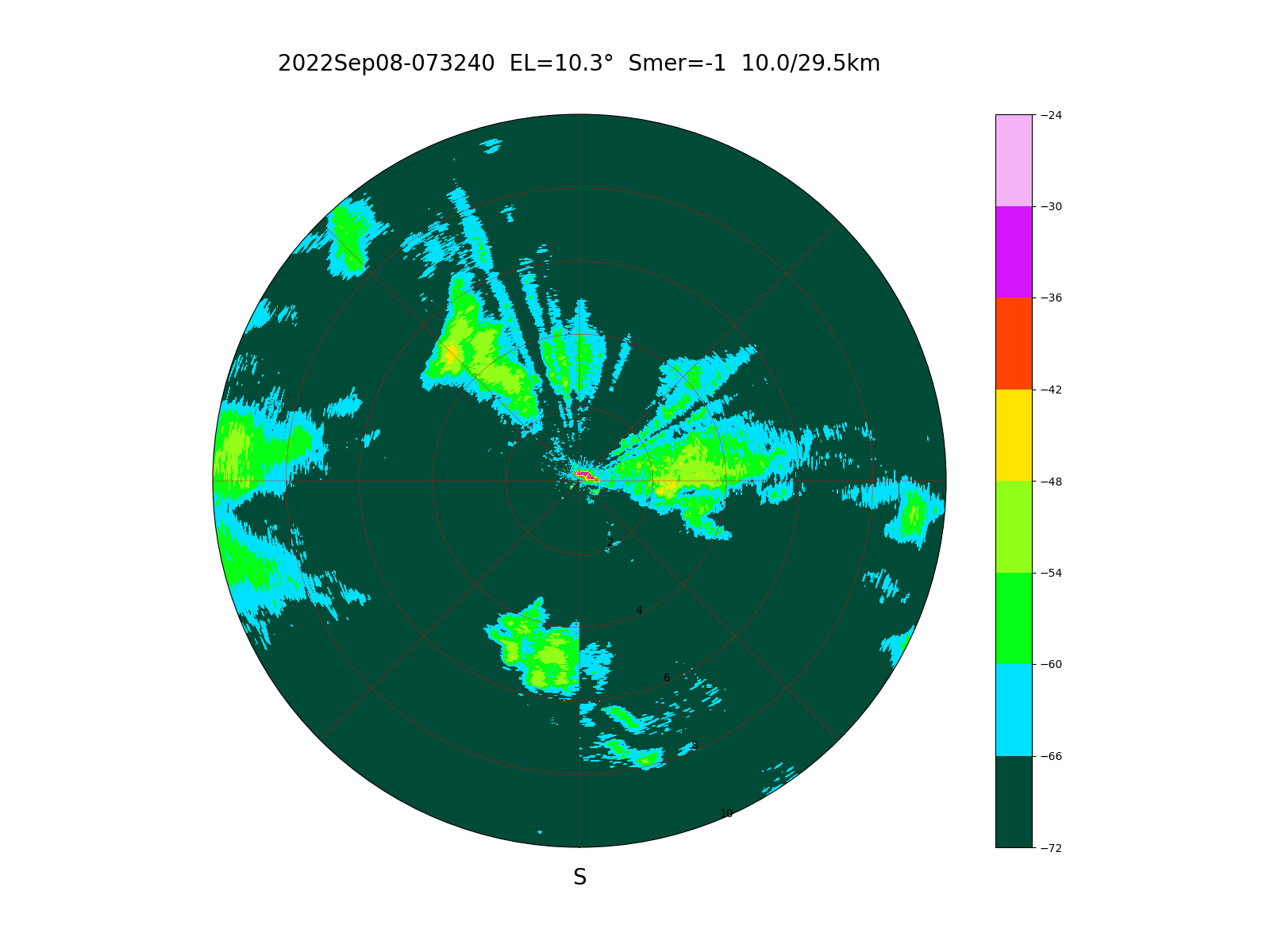
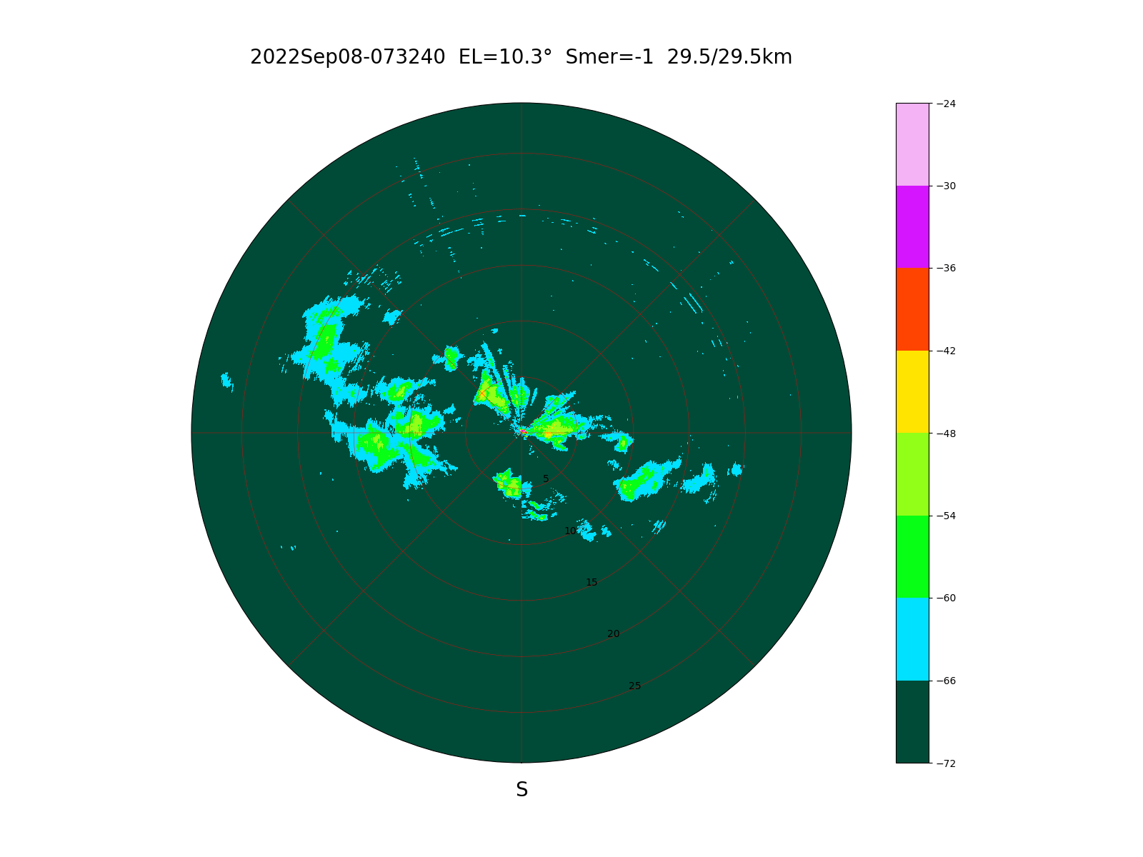
Sevaral smaller storms are visible on September 8th, 2022:
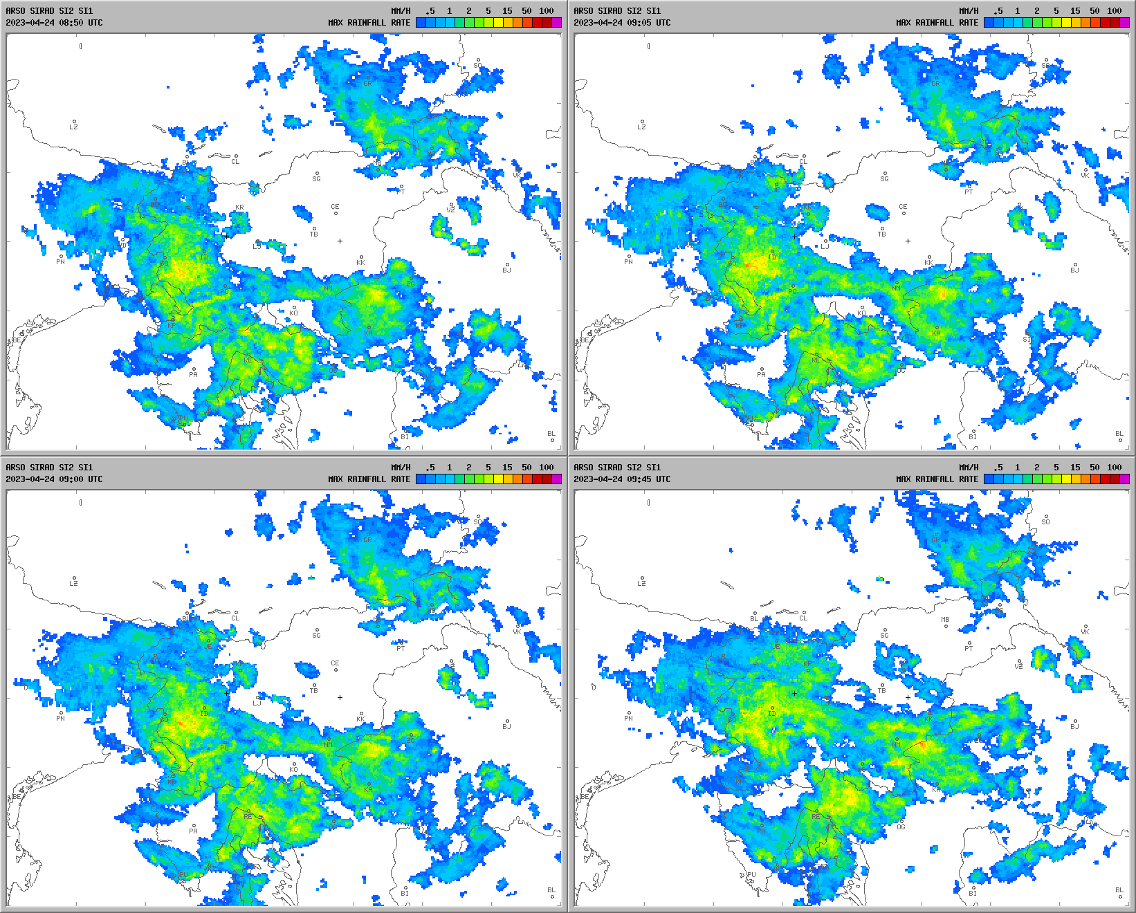
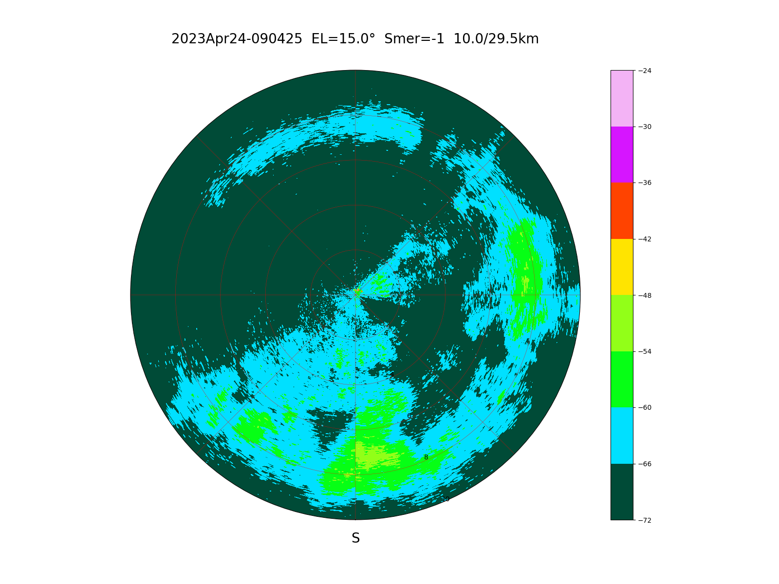
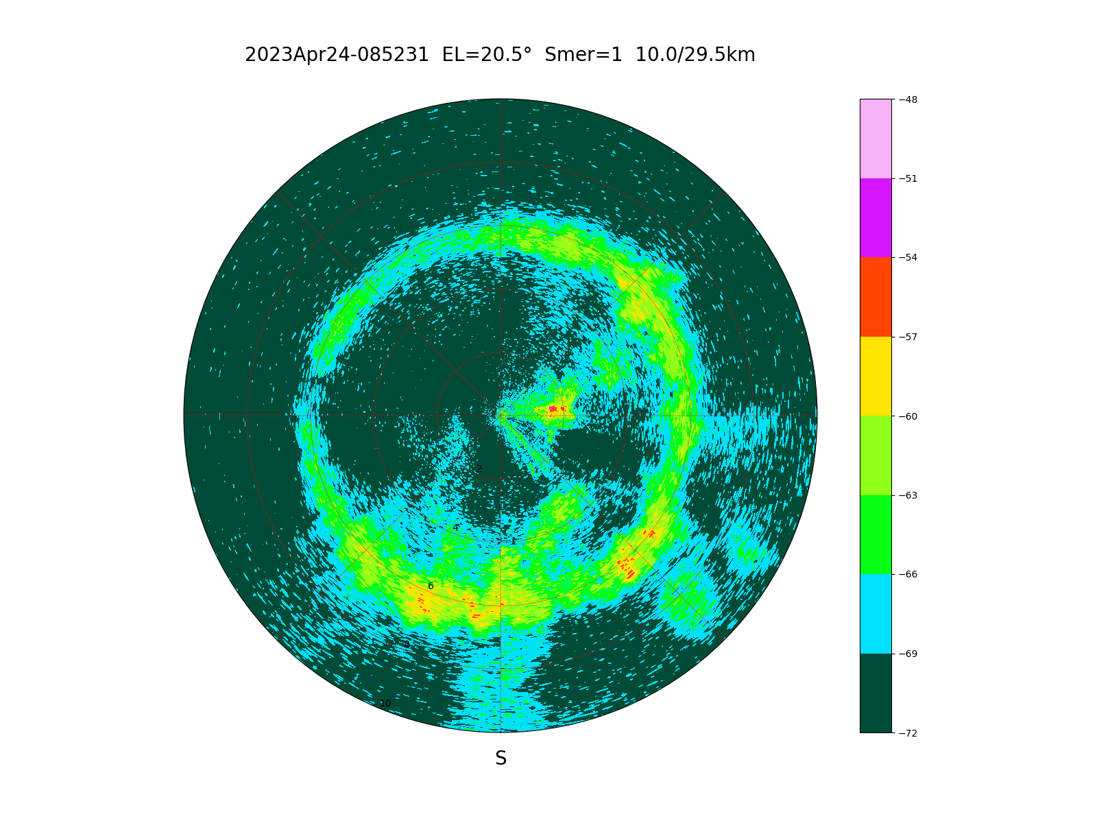
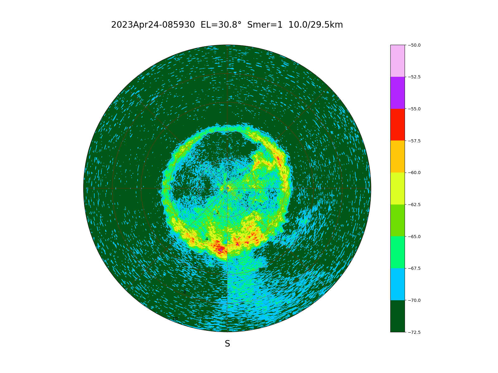
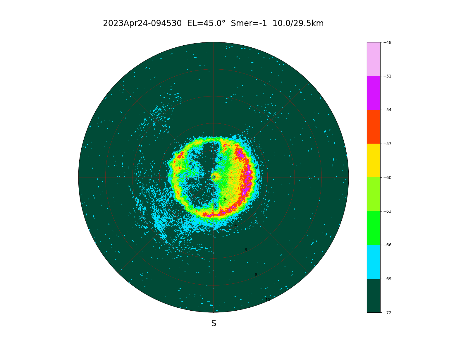
On April 24th, 2023 the sky in Nova Gorica was overcast with light rain. Several images of the local ARSO weather radar are shown for comparison:
Several scans were made at different elevations. The radar reflection is much increased at altitudes, where snow flakes (large area) into much smaller rain drops with a high dielectric permittivity. The melting of snow flakes apears as rings at altitudes given by the antenna elevation. Some weather radars combine the measurements taken at different elevations resulting in several concentric rigns on a single image.
The broadest ring appears at 15 degrees elevation:
A slightly smaller ring appears at 20 degrees elevation:
An even smaller ring apears at 30 degrees elevation:
The smallest ring appears at 45 degrees elevation, where the ring radius equals the melting altitude between 2km and 3km:
As a conclusion, several different natural weather effects can be observed with a FMCW radar with relatively small antennas and a transmitter power level of just 30mW at distances up to 25km, this range being limited by the Earth's curvature.
(RADAR) (RF-HEAD) (ANTENNAS) (PROCESSING) (WEATHER) (HOME)